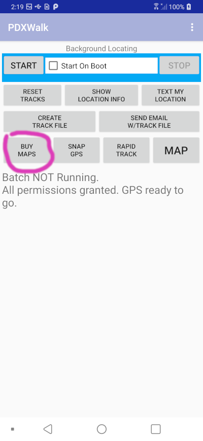
My OsmTrails Lite app for Android has two primary functions. (References to PDXWalk below should mostly apply to the new replacement OsmTrails app. )
Launching March 2025! Available on Google Play for just $3.49. Includes a small banner ad (opt-out available for EU users per regulations).
Included Free Maps:
Import Your Own Maps:
*.mbtiles files into your Android "Download" folder.
*.map files into your Android "Download" folder.Finding Additional Free Maps:
Note: "Buy Maps" option not included in Lite version. Due to large sizes (often 2GB+), extra map download links for Multnomah Falls and Portland Metro are provided free within the app.
Launching March 2025! Get the full OsmTrails App experience with extensive offline mapping and unique elevation profiles on-the-fly.
What's included?
Explore a detailed digital map showcase: ZigZag Trail Web Demo (PDXWalk)
No annual subscription. Google Play conveniently tracks your map purchases. Download maps once and use offline whenever and wherever you go!
(September 13, 2022) I created a little video trying to explain the two types of data files used by my PDXWalk hiking app (mostly same code as for OsmTrails app). A user would need to download them first, before heading out offline.
Email feedback here: Ron Ledbury.
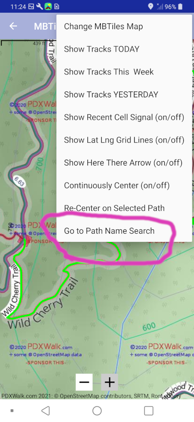
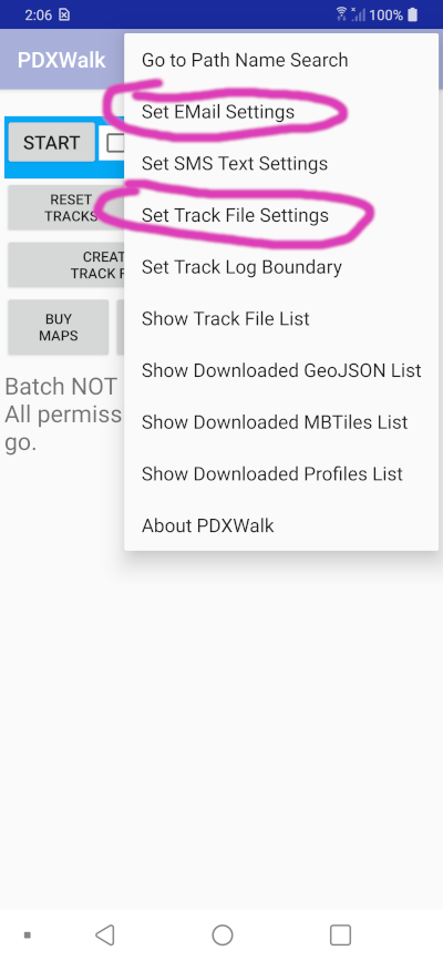
Added web page to help explain the app's Path Name Search page.
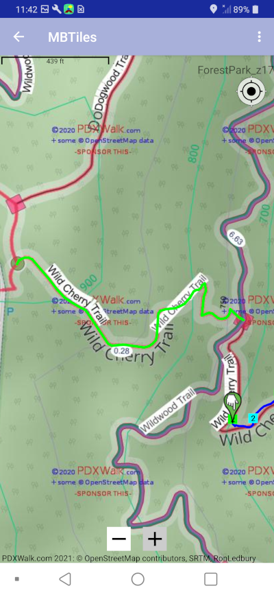
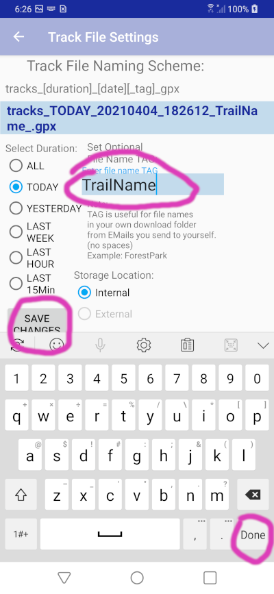
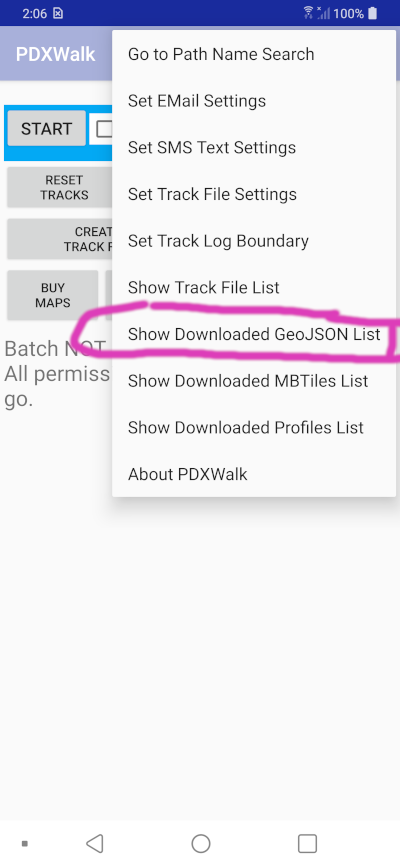
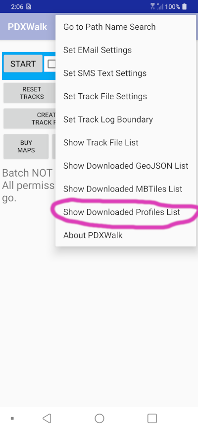
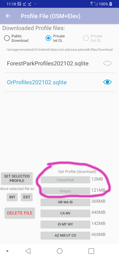
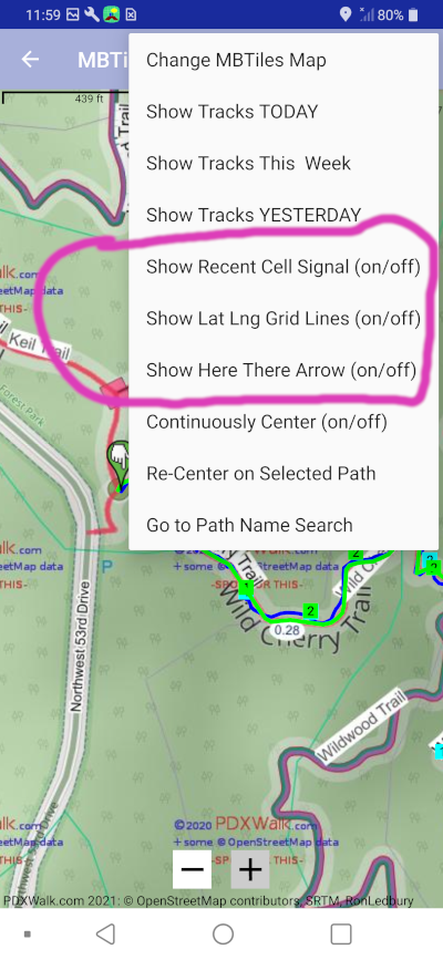
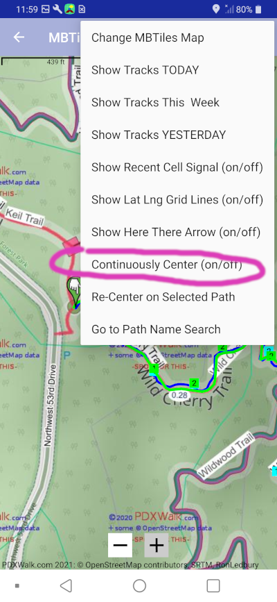
I now have Profiles files with vector data, including elevation data. Turn on the breadcrumbs menu option when on the MAP page. Provided you have downloaded and selected a Profiles file. My breadcrumbs include nearby paths and selectively some roads near center of the MAP. This is a lot more data to potentially display than just a single GPS track.
video 1
video 2
(back to old instructions . . .)
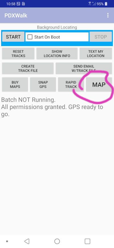
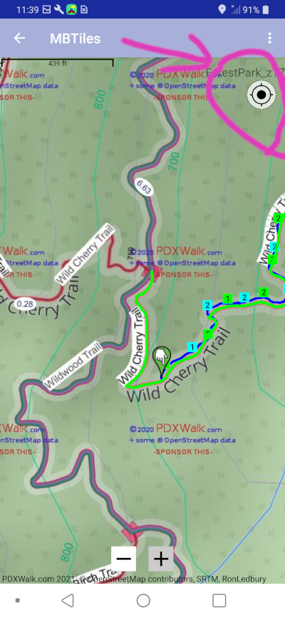
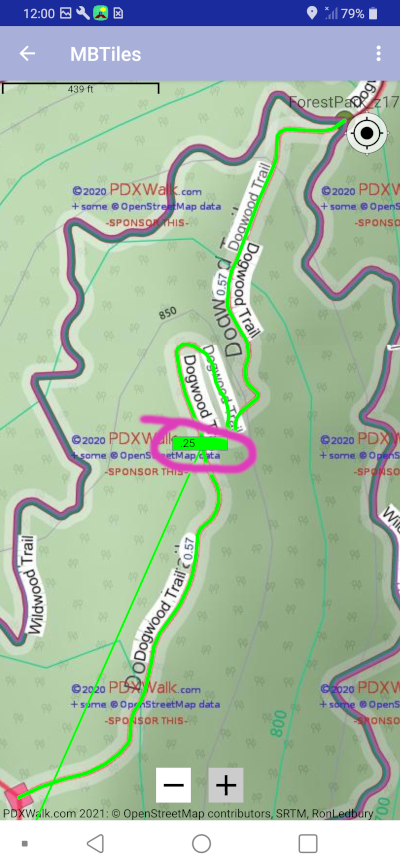
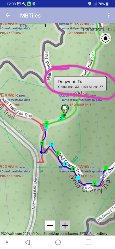
Blue line above is drawn from most recent track points. Little blue and green squares with 1s and 2s are from optionally gathered and displayed cellular signal strength data in number of bars.
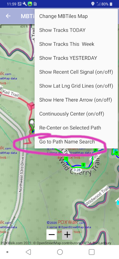
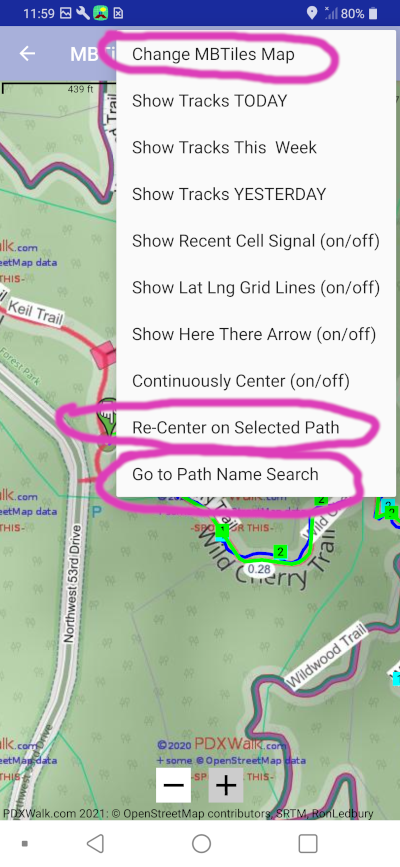
Note: You will first have to get a MBTiles map and then choose one to display in MAP, otherwise you will only see a blank map and maybe your blue line for recent tracks. Keep reading to learn how to set it up.
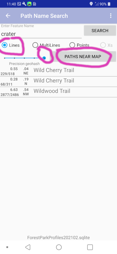
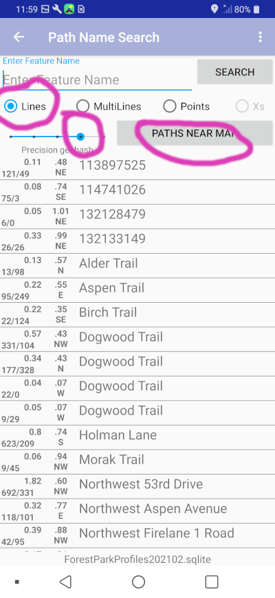
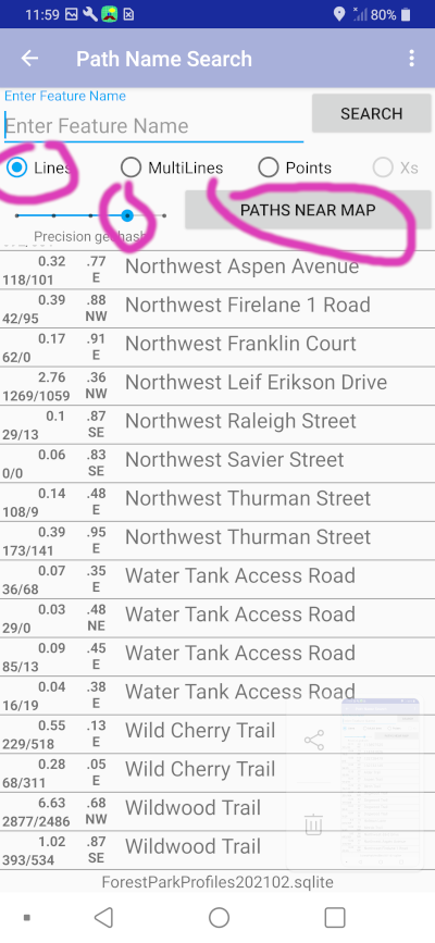
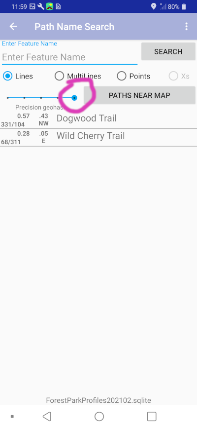
Note: Search text is ignored when we
instead just want to
find any close
path or track.
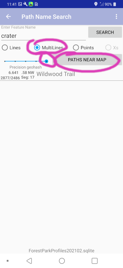
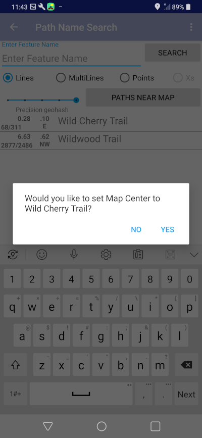
This Path Name Search feature is designed by me for me when I get lost. All I want to know then is how can I get out. Is there a nearby forest road, etc?
When finished, you can let it expire or go to the Rapid Tracking page again and stop. When I test I start many devices before hiking, then stop them at the end of hike. (Must look silly as I keep pulling devices out of various pockets, one after another.)
Note: Android has greatly improved the ability to gather these points without burning up all your battery power. But, the original "Background Locating" feature, potentially always on, now only collects data points every 5 to 15 minutes or so and delivers them even less frequently to the app. To be useful now you have to invoke "Rapid Tracking."
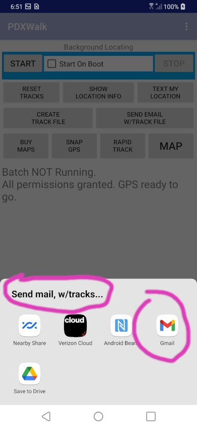
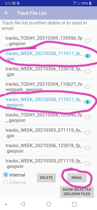
The setup is specifically designed to thereafter make it easy to simply tap the "CREATE TRACK FILE" button, and be done. Or, following that to tap SEND EMAIL W/TRACK FILE to craft an eMail with that GPX track file as an attachment ready for you to send to someone.
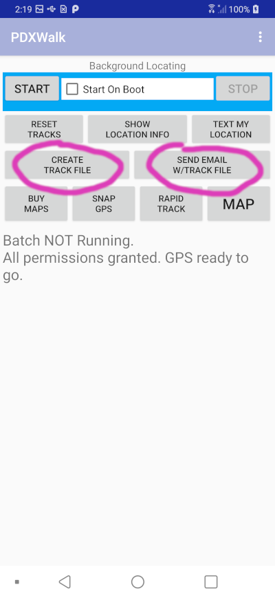
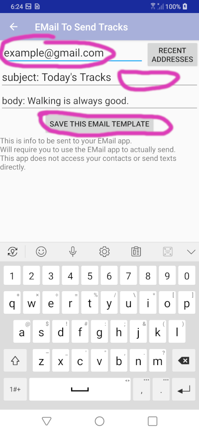
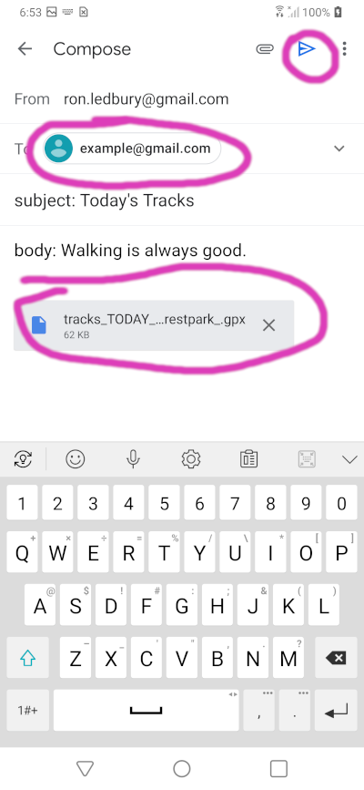
I usually just hit the blue send button to send to myself.
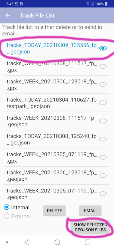
Note:: When GPX track files are created an .geojson file is simultaneously created.

[TODO: Looks like I need to sort this list.]
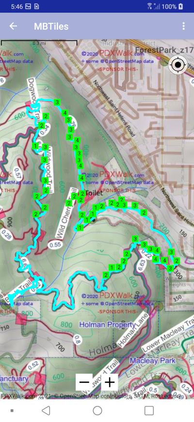
Note: The cell signal strength markers optionally displayed here are just a subset, filtered based on proximity to center of MAP.
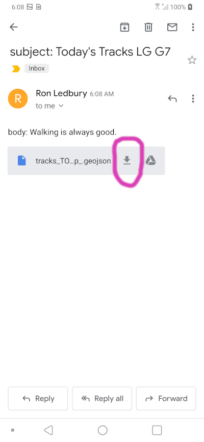
Here I sent myself an eMail with the same Forest Park hike displayed above.
This would draw the same track as that above in Forest Park.
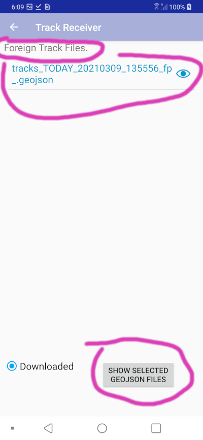
Note: GeoJSON files output by OsmTrails have just one line feature. The GeoJSON schema enables much more and some folks output huge files. The OsmTrails app cannot process files from other programs.
Note: "Track Receiver" page name is a left over from failed effort to have email app send my app the geojson attachment. Searching the shared Download folder seems to achieve the same end -- displaying someone else's track that they sent us.
Note: You can also download eMail attached GPX and GeoJSON files into the Download folder of your personal computer. From there you can drag the files over the free program GPXSee for display.
This was one of the earliest features, for me to tell someone where they could pick me up.
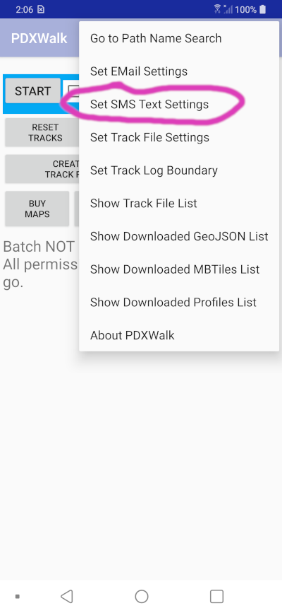
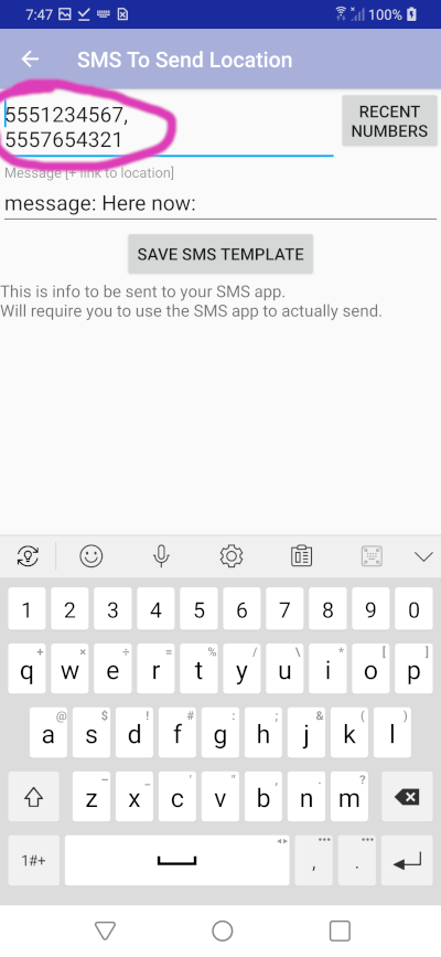
You can list up to ten numbers separated by commas.
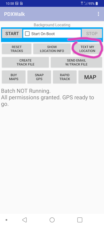

You can modify the text, etc. just you can when creating any text message.
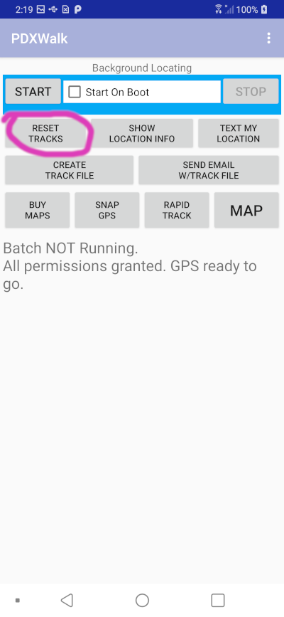
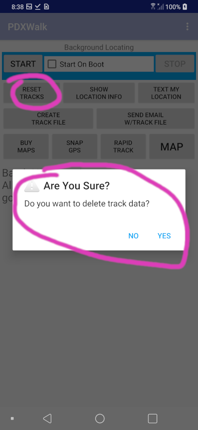
If you accidentally hit RESET TRACKS you will be asked to confirm deleting them.
You can choose to SEND EMAIL with location. Then from within your eMail app you can attach a file, and it may conveniently list your most recent photos to add to your eMail.
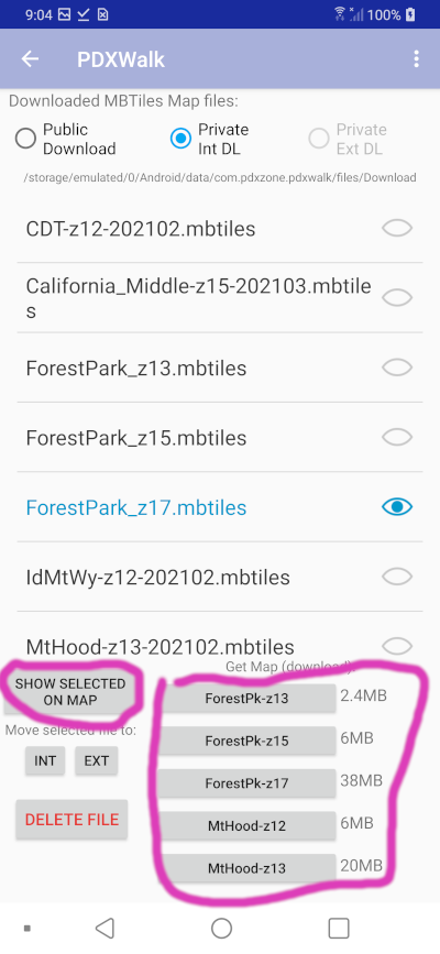
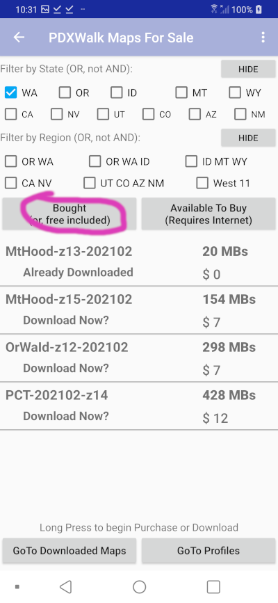
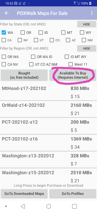
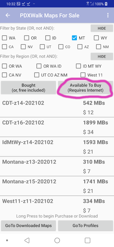
If it all works for Forest Park and for Mt Hood why not do more? Eleven western states. Z## (zoom level) is all important. As you zoom in more the file size can triple in size. The focus for OsmTrails is offline walking, so the maps only zoom in near paths. Find paths by looking for red lines on maps.
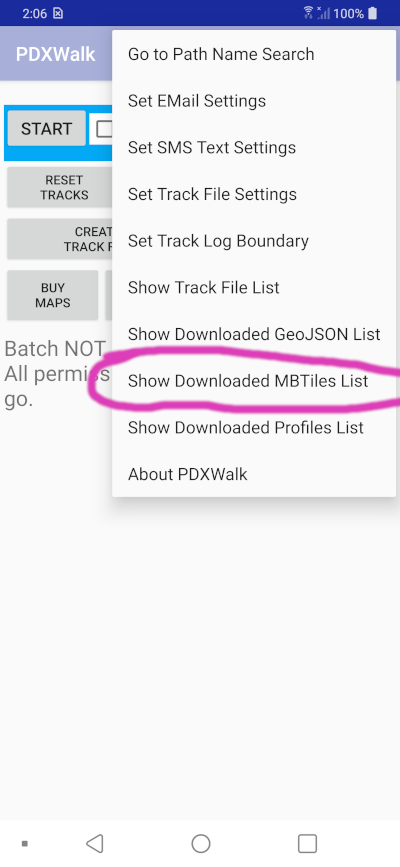
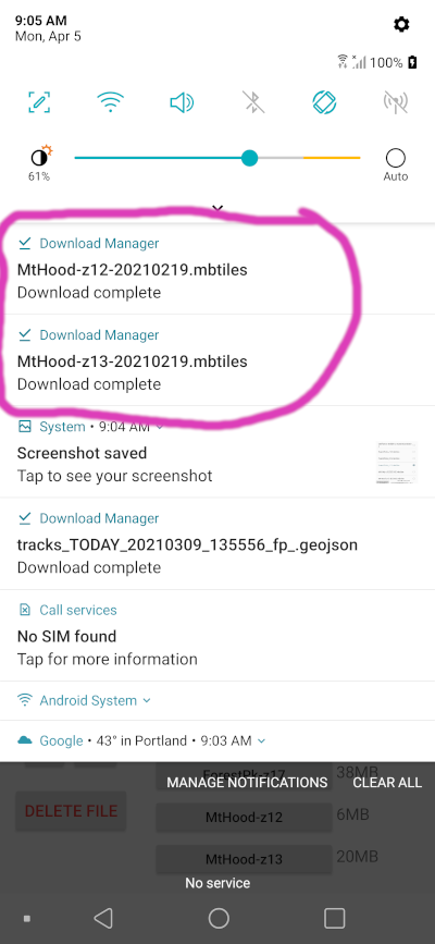
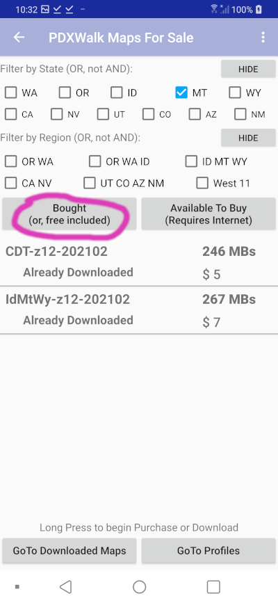
Note: Downloading requires a Long Press on the list, and a confirmation. Files can be very large and you will likely want to be near good WiFi. You will be asked too confirm that you want to start download.

One of these Profiles files must be downloaded and then set as default for Path Name Search to work. Enough data is contained in them to draw a nice profile image, even though I have not yet finished that feature. Raster maps show elevation contour and hill shading so that makes it partially superfluous.
Feel free to contribute to Open Street Maps. Contributions might then show up here in a new replacement series of maps in a year or two. [Note: Strava also uses OSM data. See their how-to-contribute-to-OSM link]
Be sure to try to download purchased maps within a year. If you have more than one device with the same google play account you can download to that other device too.
This is intended to be complete with a one time investment that is good for many years. (Maybe you might add a map or two later.) Data used for the Maps may change over time, but likely not so much that you can't wait several years before upgrading to a new series. I plan to have a reduced price scheme working to Update maps to a new series. The Android platform and development tools have already killed earlier code several times during the last five+ years since I started playing with this code. I have no control over whether they might make some catastrophic change again that mandates significant recoding.
Logging of tracks is limited to within the lower 48 US states.
SRTM elevation data has a gap in, of all places, the part of the Grand Canyon where the Arizona Trail runs through it. Contour lines and hill shading become useless at that spot.
I look forward to the story of "I was lost. Then I remembered I had this OsmTrails app installed on a cheap old Android phone as a back up tucked away in my pack. I was not lost any more."
Two ways to become a tester (April 8, 2021):
Link: How To Redeem Android Promo Code
You should always carry a printed map. Electronic gadgets and the programs that run on them are guaranteed to be fickle at precisely the time you need them the most. There are plenty of places to get printed maps. I'll point you to HikeOregon.net to possibly find a printable map. I'll call that site's hikes curated because the author actually hikes them. See great pictures and trail descriptions. Always use common sense. Sadly, having a map on a gadget takes some the original thrill and terror of being lost (temporarily) out of the experience. Knowing exactly which way to go at a fork in the trail, with no signs anywhere, is a weird feeling.
Find me on Twitter at LostRat
High-resolution offline maps carefully optimized around major trails, regions, and popular hiking destinations. Maps zoom in only near paths.
Ca_Nv-z14: California and Nevada (zoom 14)Or_Wa-z14: Oregon and Washington (zoom 14)Id_Mt_Wy-z14: Idaho, Montana, Wyoming (zoom 14)Ut_Co_Az_Nm-z14: Utah, Colorado, Arizona, New Mexico (zoom 14)Trail-specialized maps focus detail around the primary trail corridor and nearby routes. Pairing these with regional maps provides comprehensive coverage.
"California" maps are now split by the established OpenStreetMap boundaries for NorCal and SoCal at latitude approx. 35.79.
Choose any combination of maps to suit your hiking needs—without ongoing fees or subscriptions. Downloaded maps can be used repeatedly on all your personal Android devices, as tracked by Google Play.
Note for older devices: Android versions before 11 limit file sizes to 4GB; maps have been optimized to accommodate this restriction.| Map Name | Size | Price |
|---|---|---|
| Arizona-z13-202306 | 263 MB | $1 |
| Arizona-z15-202306 | 1837 MB | $9 |
| California-z13-202306 | 618 MB | $2 |
| California-z14-202306 | 1528 MB | $8 |
| California_NorCal-z15-202306 | 3237 MB | $15 |
| California_SoCal-z15-202306 | 1681 MB | $8 |
| Colorado-z13-202306 | 295 MB | $1 |
| Colorado-z15-202306 | 2354 MB | $11 |
| Idaho-z13-202306 | 273 MB | $1 |
| Idaho-z15-202306 | 2524 MB | $12 |
| Montana-z13-202306 | 364 MB | $1 |
| Montana-z15-202306 | 2374 MB | $11 |
| Nevada-z13-202306 | 311 MB | $1 |
| Nevada-z15-202306 | 1995 MB | $8 |
| NewMexico-z13-202306 | 213 MB | $1 |
| NewMexico-z15-202306 | 1212 MB | $5 |
| Oregon-z13-202306 | 394 MB | $1 |
| Oregon-z15-202306 | 2904 MB | $14 |
| Utah-z13-202306 | 267 MB | $1 |
| Utah-z15-202306 | 1935 MB | $7 |
| Washington-z13-202306 | 375 MB | $1 |
| Washington-z15-202306 | 3144 MB | $15 |
| Wyoming-z13-202306 | 257 MB | $1 |
| Wyoming-z15-202306 | 1757 MB | $8 |
| Ca_Nv-z12-202306 | 247 MB | $1 |
| US-West-z12-202306 | 1058 MB | $4 |
| US-West-z13-202306 | 3575 MB | $15 |
| PCT-z12-202306 | 282 MB | Free |
| PCT-z14-202306 | 1072 MB | $5 |
| PCT-z16-202306 | 3297 MB | $32 |
| CDT-z12-202306 | 264 MB | Free |
| CDT-z14-202306 | 779 MB | $3 |
| CDT-z16-202306 | 3053 MB | $30 |
| TahoeRim-z12-202306 | 4 MB | Free |
| TahoeRim-z13-202306 | 16 MB | Free |
| TahoeRim-z15-202306 | 109 MB | $1 |
| TahoeRim-z17-202306 | 1005 MB | $10 |
| MtHood-z13-202306 | 21 MB | Free |
| MtHood-z14-202306 | 65 MB | Free |
| MtHood-z15-202306 | 190 MB | $1 |
| MtHood-z17-202306 | 1134 MB | $11 |
| MultFalls-z17-202306 | 78 MB | Free |
| PdxMetro-z16-202306 | 228 MB | Free |
| AT-z12-202306 | 273 MB | Free |
| AT-z14-202306 | 678 MB | $3 |
| AT-z16-202306 | 2239 MB | $22 |
| US-MW-z13-202306 | 2530 MB | $12 |
| US-NE-z13-202306 | 821 MB | $4 |
| US-South-z13-202306 | 2440 MB | $11 |
| FoothillsTrail-z15-202306 | 74 MB | Free |
| FoothillsTrail-z16-202306 | 140 MB | Free |
| US48-z09-202306 | 84 MB | Free |
| US48-z11-202306 | 1163 MB | Free |
| UK-Cumbria-z13-202308 | 60 MB | Free |
| UK-Cumbria-z15-202308 | 236 MB | Free |
| UK-Britain-z11-202308 | 168 MB | Free |
| UK-Britain-z15-202308 | 4341 MB | $20 |
This list is auto-generated. Actual availability and prices might vary slightly by time of purchase.